In an era defined by compounding environmental pressures, climate volatility, and rapid land-use transformation, the global remote-sensing community faces a persistent bottleneck: translating vast, multidimensional satellite archives into actionable, computationally efficient insights. Today, the Allen Institute for AI (Ai2) has fundamentally shifted this paradigm with the general availability of custom-computed embedding vectors within OlmoEarth Studio.
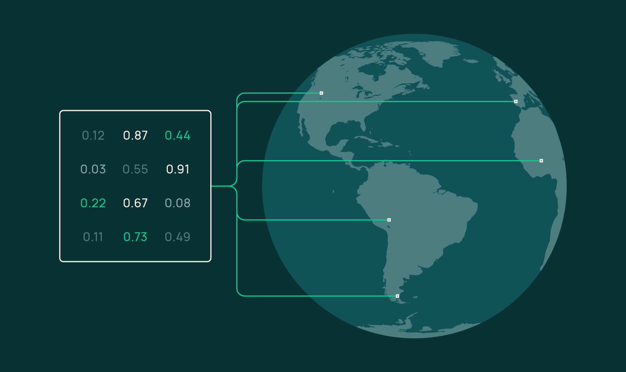
By harnessing Ai2’s open-source OlmoEarth foundation models, Earth observation scientists, researchers, and developers can now extract, compress, and export compact numerical representations of planetary data. These vector arrays transform complex satellite imagery from raw pixels into mathematically rich, semantically meaningful spatial coordinates.
The launch bridges the gap between massive, resource-intensive foundation models and practical, everyday geospatial analysis. Operating as a fast, cost-effective entry point for downstream environmental modeling, OlmoEarth embeddings empower users to perform everything from similarity search and few-shot land-cover segmentation to multi-temporal change detection and unsupervised ecological exploration using lightweight Cloud-Optimized GeoTIFFs (COGs). With source code, model weights, and extensive documentation publicly accessible on GitHub and Hugging Face, Ai2 is not merely offering a new analytical tool—it is democratizing the core architecture of modern geospatial intelligence.
Detailed Chronology & Technical Genesis
The journey toward OlmoEarth embeddings represents the culmination of years of iterative progress in machine learning architectures tailored specifically for geospatial observation. For decades, remote sensing relied on deterministic indices—such as the Normalized Difference Vegetation Index (NDVI)—or bespoke deep-learning models trained from scratch for singular, isolated tasks like deforestation tracking or urban sprawl mapping. These methods were inherently brittle, computationally expensive, and notoriously difficult to scale across diverse geographic regions.
The Foundation Model Shift
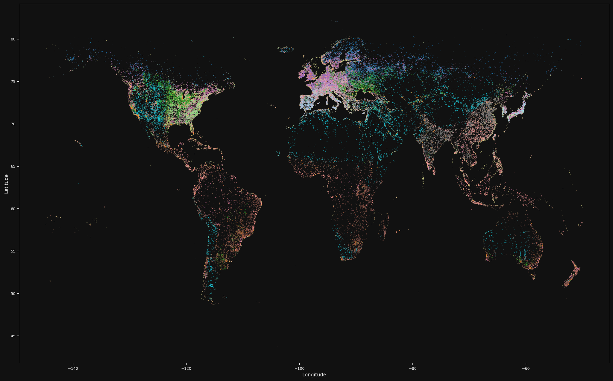
The paradigm transformed with the advent of multimodal vision encoders and self-supervised pretraining. Ai2’s development of the OlmoEarth framework broke from traditional constraints by training models on millions of global, multi-sensor samples, teaching neural networks to inherently understand topography, phenology, urban morphology, and hydrological dynamics without relying on manual annotations.
Phase 1: Architecture and Pretraining. Ai2 released foundational model weights and source code, allowing the open-source community to inspect the exact mechanisms by which visual Earth-observation data is mapped into high-dimensional latent space.
Phase 2: The Studio Integration. Recognizing that raw model weights require specialized machine learning infrastructure to deploy, Ai2 engineered OlmoEarth Studio—an intuitive user interface and API layer that abstracts away the infrastructure overhead. Users can define custom spatial boundaries, temporal ranges, encoder variants, and resolution parameters.
Phase 3: The Embedding Export Milestone. The latest platform update introduces direct computation and export of dense embedding vectors. Rather than locking predictions inside a proprietary ecosystem, Studio delivers standardized COGs where each band corresponds to an embedding dimension. Encoded as signed 8-bit integers (int8) to minimize storage footprints, these arrays can be effortlessly ingested into standard geospatial software packages like QGIS, GDAL, and Python libraries such as rasterio.
Supporting Context & Metrics: Unlocking the Power of Latent Space
To understand the utility of OlmoEarth embeddings, one must examine how high-dimensional feature spaces capture physical reality. When an encoder processes satellite imagery—such as seasonal Sentinel-2 Level-2A composites—it projects physical surface characteristics into a multi-dimensional mathematical vector. Pixels sharing identical ecological or anthropogenic traits map closely together in vector space, while dissimilar landscapes land far apart.
1. Similarity Search ("More Like This")
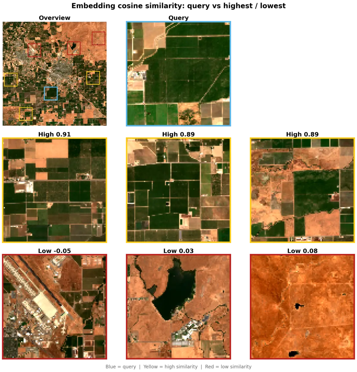
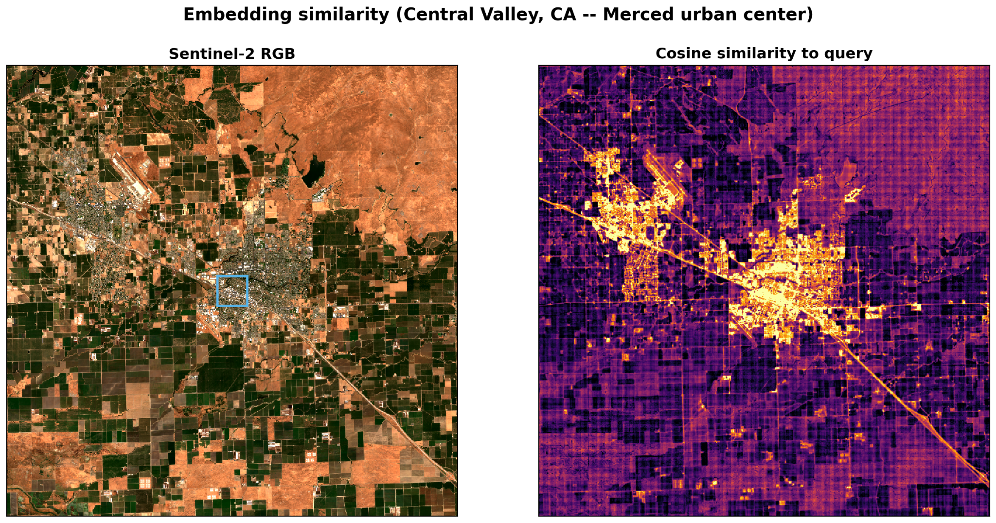
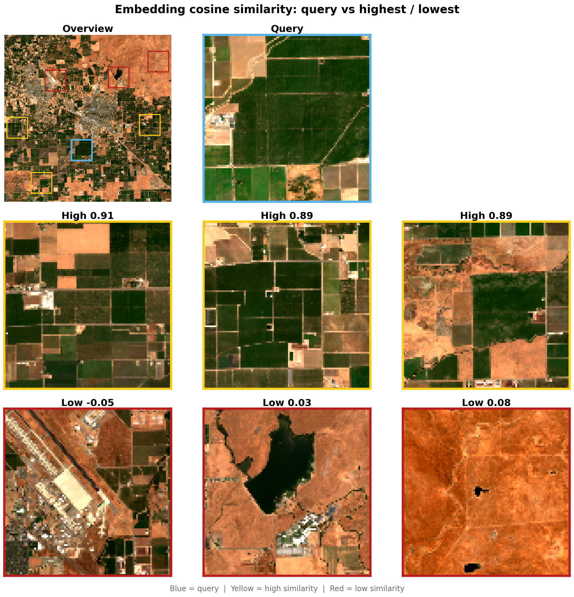
By selecting a query pixel or spatial window, an analyst can compute the cosine similarity against every other pixel in a regional raster. In test deployments near Merced, California, querying an urban center immediately illuminates built-up fabrics and road corridors in high-similarity heatmaps while keeping agricultural parcels dark. Conversely, querying an irrigated agricultural window successfully identifies distant, similarly managed crop fields with similarity scores exceeding 0.89, while cleanly isolating airports, reservoirs, and arid rangelands down near zero. Crucially, this differentiation occurs entirely through vector mathematics, free of pre-existing training labels.
2. Few-Shot Segmentation
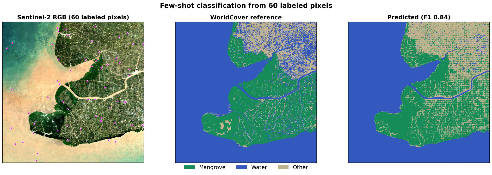
Discrete land-cover classification traditionally demands thousands of meticulously hand-drawn training polygons. OlmoEarth embeddings dramatically reduce this friction through linear probing. In an independent evaluation covering the coastal mangrove swamps of Ca Mau, Vietnam, researchers trained a standard logistic regression classifier using just 60 labeled pixels (20 per class: mangrove, water, other) derived from ESA WorldCover data.
Performance Metric: The resulting wall-to-wall classification achieved a weighted F1 score of 0.84.
Efficiency: Increasing the training label count from 30 to 300 yielded negligible accuracy improvements, proving that the foundation model’s pretraining phase had already completed the heavy analytical lifting.
3. High-Resolution Temporal Change Detection
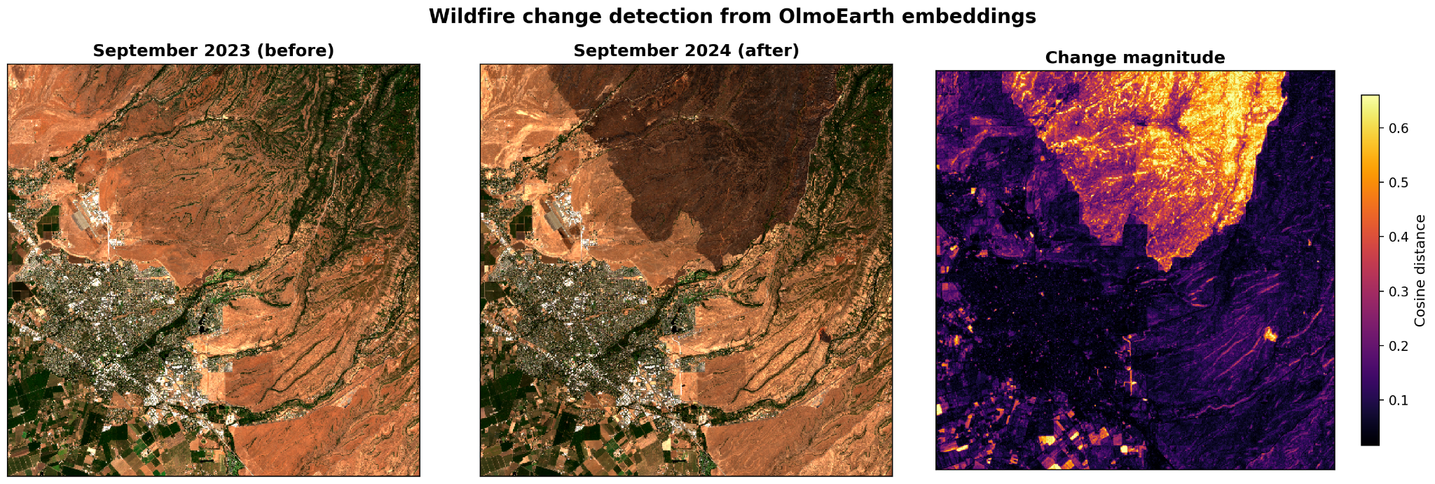
Because OlmoEarth Studio enables on-demand temporal slicing—generating monthly composites rather than relying solely on generalized annual snapshots—analysts can directly evaluate ecological disruption. Comparing monthly embeddings from September 2023 against September 2024 via per-pixel cosine distance immediately highlighted the catastrophic burn scar of the Park Fire in Butte County, California, without requiring complex spectral index thresholds or manual feature engineering.
4. Unsupervised Structural Exploration
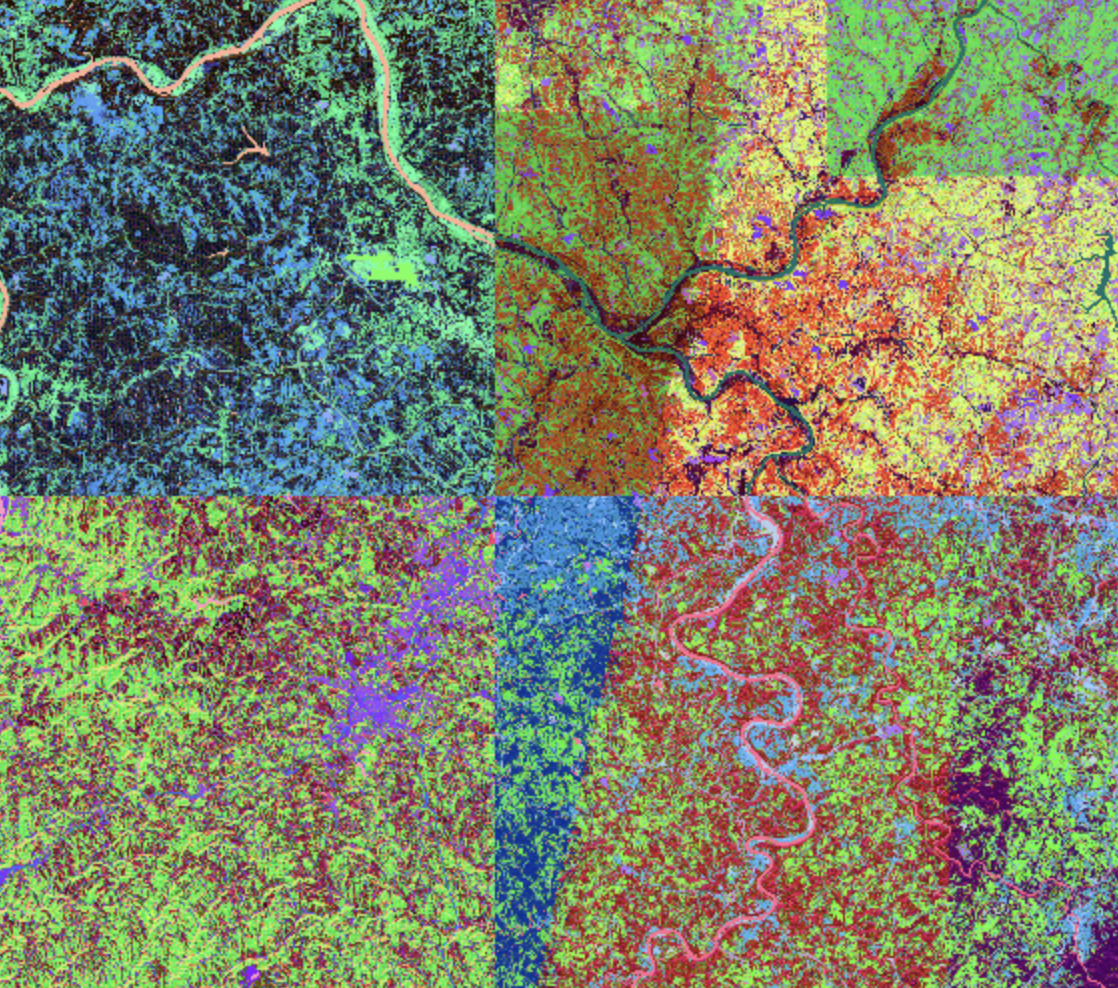
For regions lacking prior ground-truth data, Principal Component Analysis (PCA) can be applied directly to the embedding bands. Compressing high-dimensional vectors down to three dimensions and mapping them to RGB channels reveals hidden structural patterns. In Flevoland, Netherlands, this unsupervised PCA approach accurately reproduced the intricate, man-made agricultural polder grid, clearly delineating distinct crop cycles and water infrastructure based solely on the model’s internal representations.
Official Statements & Community Perspectives
The release of OlmoEarth embeddings underscores Ai2’s ongoing commitment to open science and accessible ecological monitoring. While institutional developers frequently highlight the computational hurdles of deploying massive geospatial AI models, the architecture of OlmoEarth addresses these barriers directly.
"Embeddings offer a fast, cost-effective entry point for leveraging OlmoEarth," notes the development team in technical documentation. "Locations with similar surface characteristics end up with similar vectors; locations that differ land far apart. By providing lightweight Cloud-Optimized GeoTIFFs, we are ensuring that advanced machine learning insights remain accessible to researchers working in resource-constrained environments."
Independent benchmarking has further validated the robustness of these representations. Whether utilized via the lightweight OlmoEarth-v1-Tiny (192 dimensions at 40-meter resolution) or scaled up to the Base variant (768 dimensions), the models consistently demonstrate high transferability across diverse biomes, ranging from dense tropical rainforests to arid agricultural basins.
Future Outlook: Fine-Tuning and Next Horizons
As geospatial artificial intelligence transitions from experimental research to operational deployment, tools like OlmoEarth embeddings point toward a more responsive, transparent future for environmental monitoring.
While frozen embeddings provide an exceptional baseline for similarity queries, rapid classification, and exploratory data analysis, Ai2’s roadmap acknowledges that certain high-stakes applications demand even greater precision. For users requiring peak predictive performance, OlmoEarth Studio concurrently supports Supervised Fine-Tuning (SFT), allowing organizations to train specialized model heads on proprietary, localized datasets.
However, challenges remain. As developers note, output quality is inextricably tied to input fidelity: persistent cloud cover, atmospheric distortions, or observational gaps in satellite composites can subtly influence vector trajectories. Ongoing pretraining innovations aim to mitigate these artifacts, ensuring even greater resilience against atmospheric interference.
Getting Started
Custom-computed embeddings are now live within OlmoEarth Studio. Researchers and developers interested in leveraging the platform can reach out via the official OlmoEarth portal. For immediate hands-on experimentation, Ai2 has provided comprehensive Python tutorials, GitHub repositories, and a zero-setup Google Colab notebook, ensuring the global community can begin decoding our changing planet immediately.